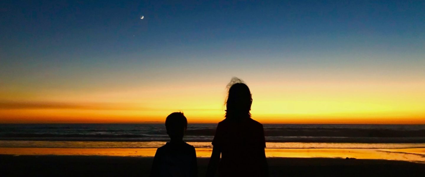
I love the name. Snæfellsnes is among the simpler names in Icelandic geography. Last time eight years ago, Jo and I nicknamed this area “Snefellopholous” for unknown reasons. The peninsula is a 90 km long protrusion of volcanic land (of course) off the central coast of western Iceland and is often described as the best of Iceland in miniature. The western end of the peninsula is home to the famous Snæfellsjökull volcano and glacier. It last erupted 1750 years ago, though an official sounding Icelandic volcano website say that there may have been “fresh lava flows more recently”. While Snæfellsjökull is well known in Iceland, both geographically and historically, I became aware of its existence when I read Jules Verne’s book which was required reading when I was about Evan’s age. The characters start their journey to the center of the earth by rappelling down its crater. Unfortunately Jules Verne hadn’t visited Iceland and didn’t know that the top of the volcano is a jökull – a glacier covered in two or three hundred meters of solid ice. Or perhaps the very smart Verne accounted for climate change, but just a bit too soon. It is estimated that this mighty glacier will cease to exist before Vivian’s generation does.
Today Jo has planned an easy day, in and back out along the southern coast of Snæfellsnes as far as we want to go. We’ll be here for two days.
After a nice breakfast at the B59 hotel in Borgarnes, I strolled down to the local Netto grocery store across the street and discover dry sausage snacks to replenish the several pounds of the finger sized Costco salami that the kids consumed yesterday. Then we refilled gas, marked in Iceland at the pump as “bensin”. We paid over $11/gallon but we are paying per liter in ISK. Unless you do some quick math in your head, you don’t know enough to cringe. As we are about to leave Jo and I proceeded to have a volcanic sized disagreement about the location of the local farmer’s market.
Jo wants to drop in on the local farmers market. It is a women’s group that makes and sells high quality local handmade sheep wool products and jams and fresh foods. The description sounds inviting and I love a good farmer’s market. I’m looking for tents in a parking lot. The directions and pictures point to the building that houses the Netto grocery store. Perhaps it used to be there and has moved or closed or is seasonal. So Alu and I drive our cars around a quarter mile patch fruitlessly while Jo and Michelle exchange directions and text messages and then I make an executive decision to skip it and move on. Just as I am leaving the parking lot I see a store out of the corner of my eye. It’s in a strip mall in the next building past the Netto and says “FARMER’S MARKET”. But by then Jo is pissed and I’m defensive and I drive on. For posterity, here’s the location on google maps and a picture of the store from the parking lot (thank you, internet). My dearest, if we return to Borgarnes we will stop here. I’m sorry.


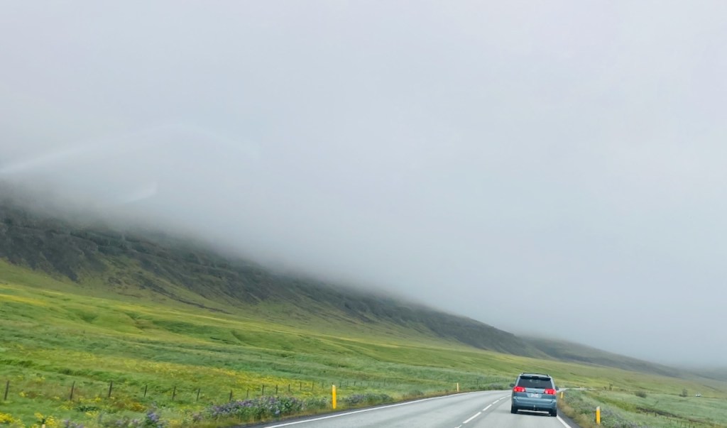
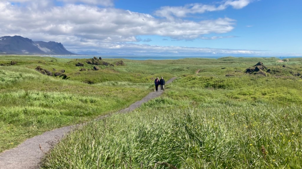
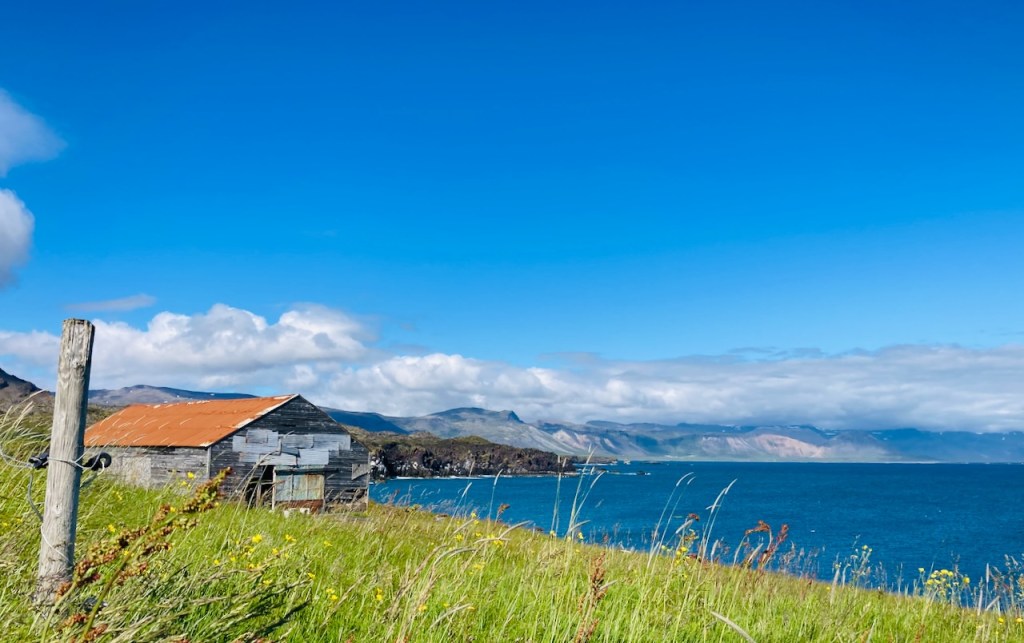
We are in Snæfellsnes after driving in icy silence for half an hour. Here’s what it looks like – a two lane road without shoulders snaking its way over narrow coastal flats covered in the greenest imaginable grass and moss. Mountains rise up on the other side, often shrouded in clouds that seem to be gently pouring down. When the clouds lift you catch glimpses of impossibly high snowy mountain tops or perhaps they are just more clouds. After the golden circle, this part of Iceland is the most touristy but the traffic is light and you can go for a while without seeing another car. We encounter few sheep in groups of three, the mother ewe with an enormously engorged udder and two absolutely cute kids. The sheep loiter and run off the road with the cutest butt-up-in-the-air gallop as cars approach. The edge of the roadway is marked by ubiquitous yellow stakes every 50 meters or so. This isn’t a country of guard rails and you often round a bend at the edge of a cliff looking down hundreds of feet to waves crashing on lava rocks, imagining your dreadful demise in this paradise of stunning views, and then a short yellow plastic stake pulls you back to safety. We stop to walk to a rocky beach to see seals. There is a QR code attached to a fence post and a request to pay for parking. The stiff breeze from yesterday has died down and it is shaping up to be a glorious day. We chill and walk around on the beach, watch the seal pups, take photos, relax. Thanks, Alu, for many of these photos.


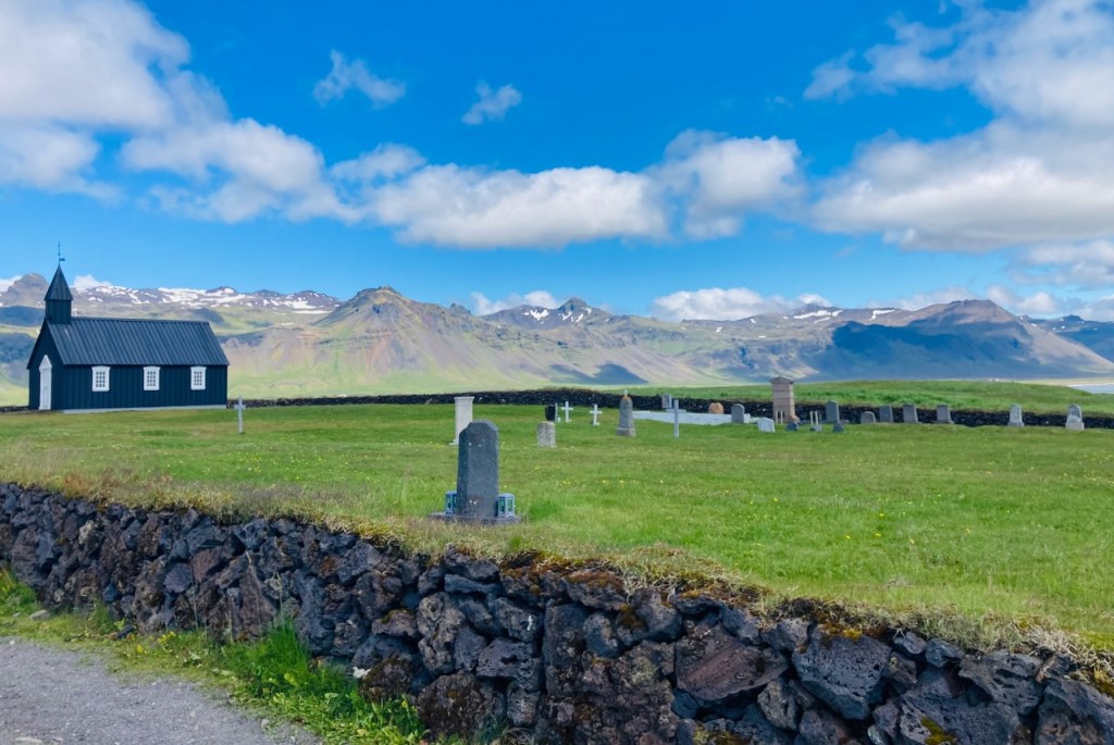
Our next stop is a few miles westward to the famous “black church” of Búðir. An informational sign announces that “…a quote on a door ring says that this church was built in 1848 without the support of the spiritual fathers“. Initially built in 1703, the parish was abolished in 1816, but a local wealthy woman eventually got royal permission to rebuild the original rotting building in 1848. The current building was reconstructed and consecrated in 1987. The bell is still the original and was cast in 1672. The church and the attached cemetery are serene. We walk to the beach over rolling fields of grass and outcroppings of lava rock. A few minutes away is a nice old hotel where we stop for hot chocolate and the best fish soup I’ve tasted. I ask for the recipe. I’m told they simmer the broth for 48 hours, smoke the fish, and at the table the waiter pours the piping hot soup into a bowl with Icelandic buttermilk froth, butter, and fresh local herbs at the bottom.

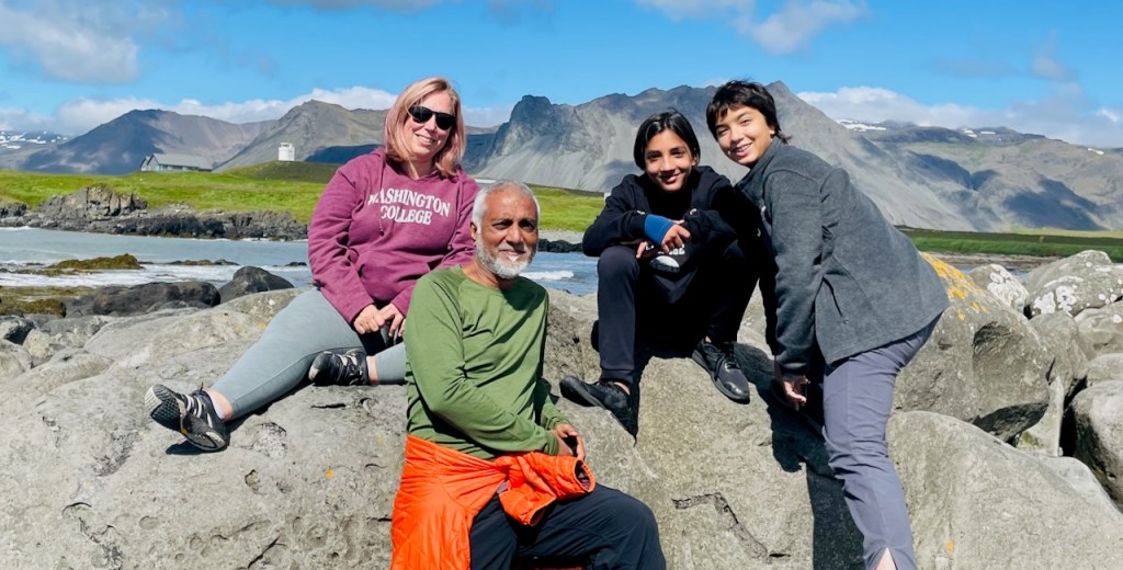
A handful of miles farther down the coast we stop to admire the black lava cliffs and formations at Arnarstapi, Hellnar, and Lóndrangar. Vivian and Evan take off down a steep slope towards the towering lava columns at Lóndrangar. Jo and I have noticed something different here. Back in Austin, Vivian and Evan inhabit the same house. They lead separate lives, go to different schools, have non-overlapping groups of friends for the most part, and do different things with their free time. When they do interact, it is mostly though jokes and friendly barbs. Here in Iceland, they link arms and run off to explore together, laughing and chasing and jousting with each other.

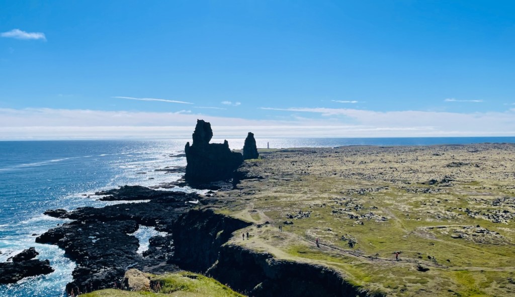
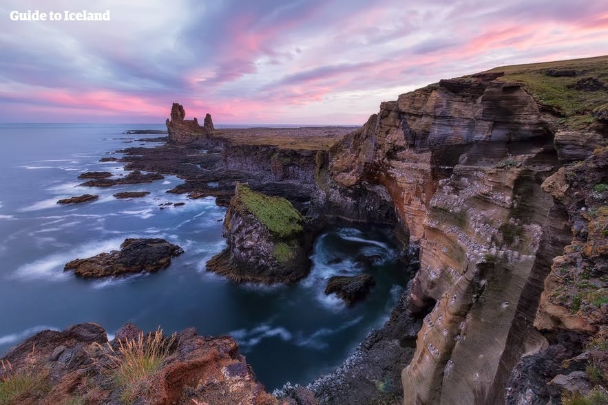
Above are two photos of the same spot. Alu took the one top on his iPhone. You can see a path towards the bottom right. Somewhere along that path is me. A bit further up are Vivian and Evan. We are in a flattish lava field covered in moss, heather and grass. In front of us are the towering columns of ancient lava tubes. And in the distance, just before the sea is the needle-like Malarrif lighthouse marking the southwestern edge of Snæfellsnes. Vivian, Evan and I walk to the lighthouse, and Michelle and Alu and Jo drive there to meet us. Along the way we find a beautiful black bounder beach and a short zip line that everyone rides twice. Vivian and Evan alternately race and pummel each other into the velvety moss while laughing over some joke that they share. The next photo is a lovely picture that you will see on a tour website or someone’s curated insta story. The lighting in perfect. The sky is amazing. The photographer has selected and framed the scenery beautifully. Here’s the funny thing – it looks better that even this photo when you are here on an ordinary day.
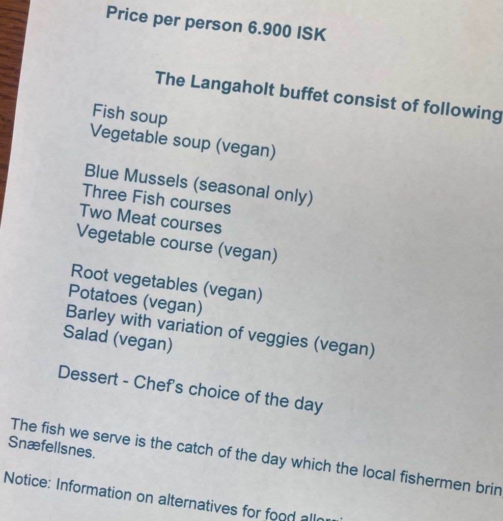
We stop at the Langaholt guest house where Alu, Michell and I enjoy a nice cold beer (from the car – no cooler or ice required) and sweeping views of the coast. We sit down for a great dinner (thanks, Alu), and drive to our lovely modern cabin in the Miðhraun (“middle of lava” in English) Lava Resort (it’s a bit like chai tea for those who know :- ). End of Day Two. I’m loving traveling. I’m loving Iceland.
