We flew from Reykjavik to Boston, spent the night at an airport hotel, and continued at the crack of dawn to Kansas City where I had parked Jo’s car about three weeks ago. Before lunch we are driving past rolling fields of corn, dark green and already taller than we are. Carol is expecting us. She has left Sadie in her bedroom so that when we arrive, Ouiser can greet us properly without having another dog around. The kids grumble that Grandma has never shown this level of consideration for her grandkids. Jo adds that Carol was never this nice to her kids. Ouiser has been very well cared for.
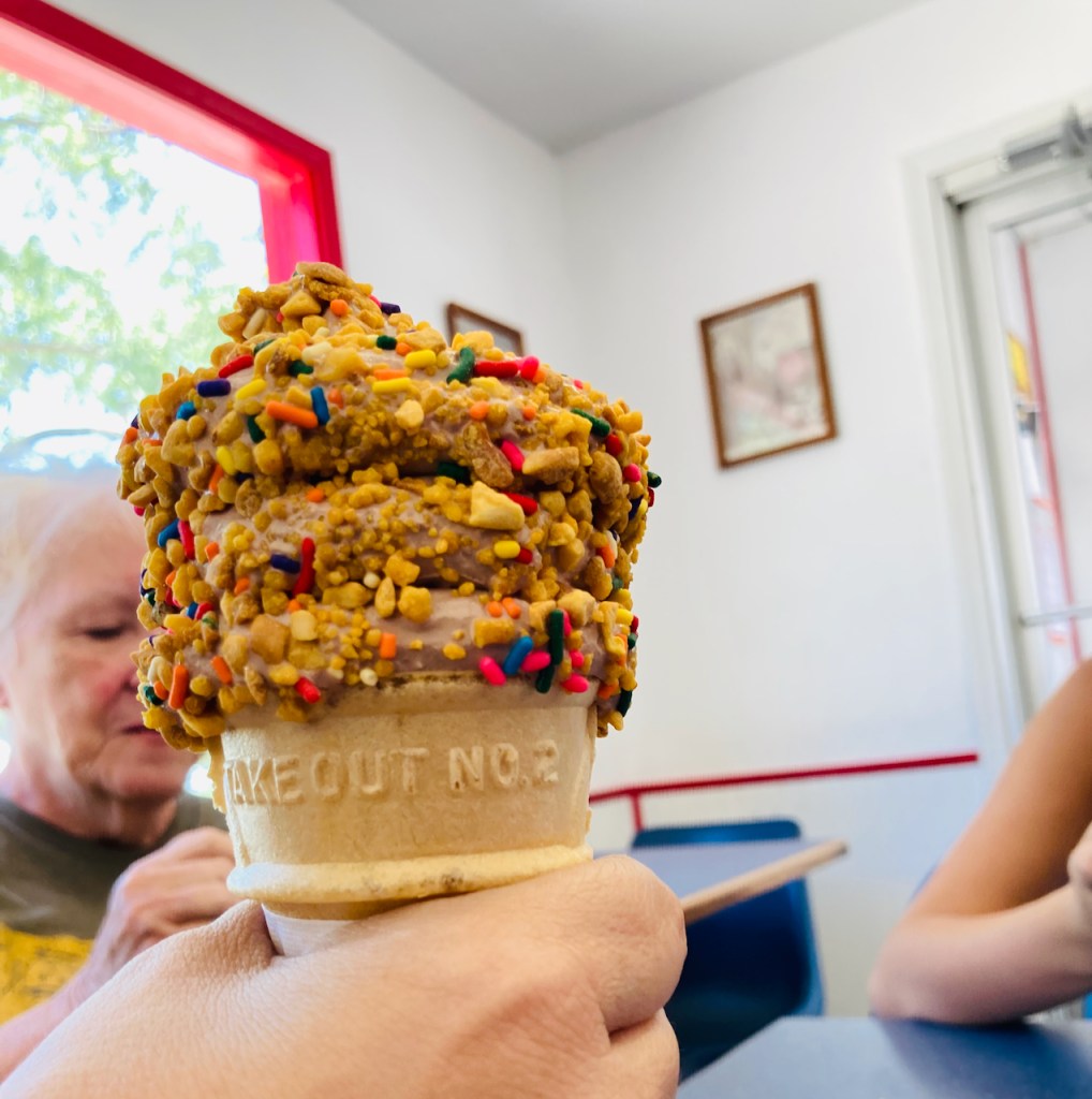
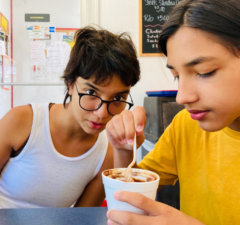
The next few days in Dawson are slow and easy. The only things we really do is walk the dogs up to Heim cemetery and go to Frosty Queen for crunch cones. One day I get to visit the fields with Tom. As usual Tom patiently answers my questions about everything – corn futures, the internal workings of combines, an infestation of Japanese beetles. I see the copper and green Japanese beetles first hand eating their way through soy bean leaves. A crop duster flies low overhead dusting a neighboring field.
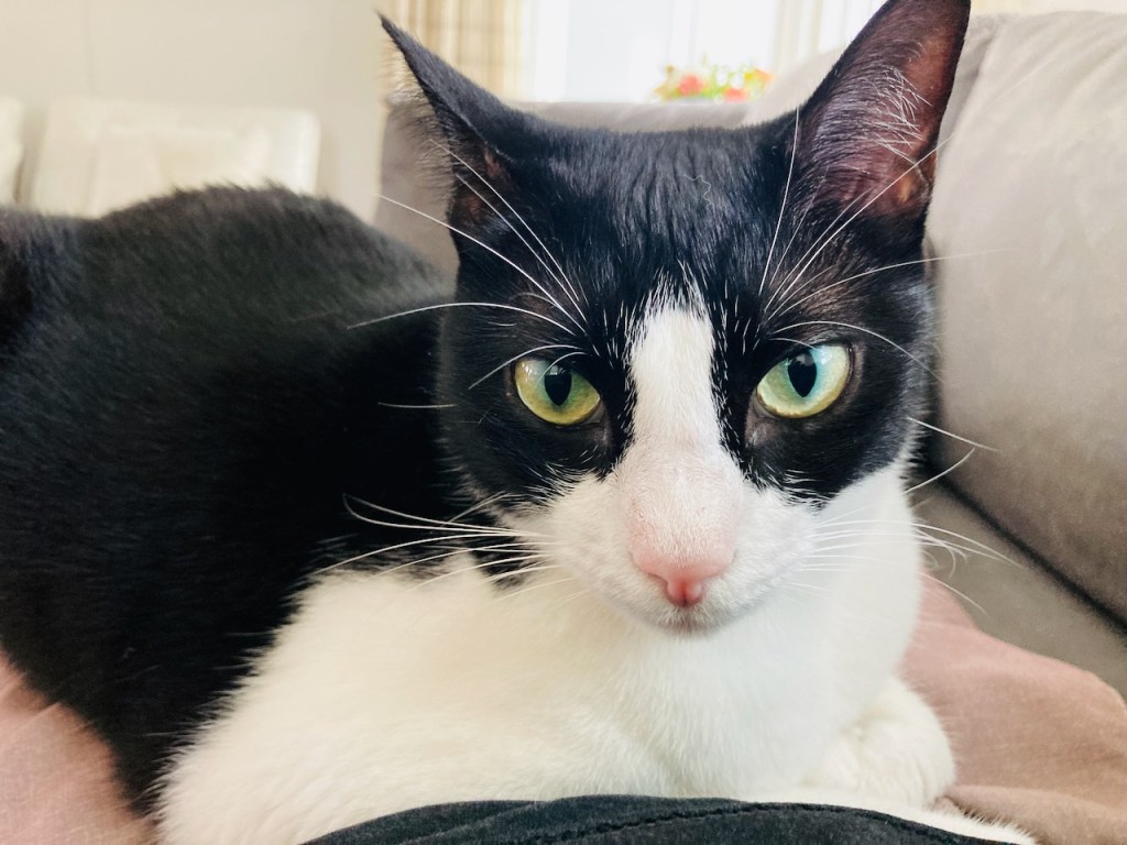
Carol has helped Vivian learn how to crochet and has given her a hook and yarn. Vivian and I fly back from Kansas City airport to home. She crochets obsessively all the way back. Over the next few days she makes herself a very shaggy looking sweater and calls it “cottagecore” while I call it ugly. At home we are greeted very vocally by our dear Zeus who tells us all about how she has been alone for weeks and that we are assholes, over and over again. She lays on top of us meowing very loudly.
In a few days Ouiser, Jo and Evan drive back to Austin from Nebraska and we are finally back to full strength at the white wooden house. Soccer and the schools start up. Summer is supposedly over and it is only a 100 degrees outside. Vivian is in 10th (I have a hard time wrapping my head around that) grade and Evan is in 7th.
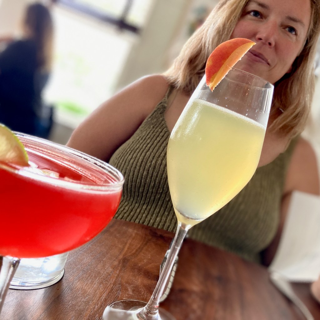
It has been another epic summer trip, especially our 3000 km drive around Iceland. But we are happy to be back home and reunited with our furry kids. Once the hairless kids are in school Jo and I go for a nice brunch to Josephine House and enjoy our customary back to school celebration. Cheers to another academic year.
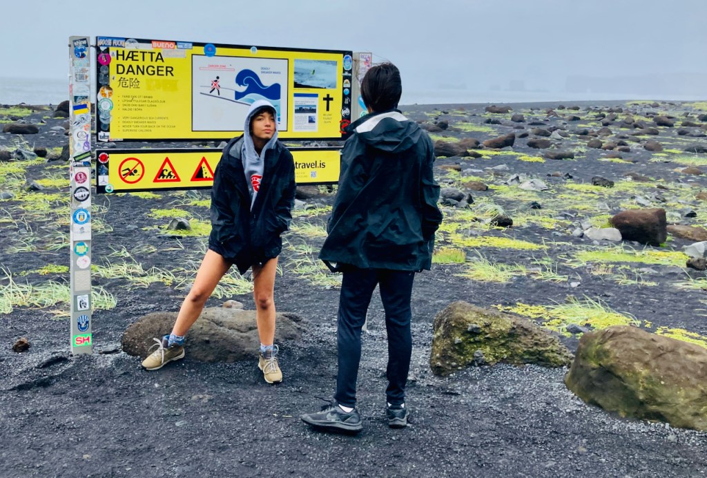
After breakfast we climb the steps to the observation platform overhanging Skógafoss. Then we pack up and drive to nearby Reynisfjara Beach. During the short drive the weather turns from beautiful summer morning to North Atlantic gale. By the time we arrive at the beach the rain has mostly stopped but the wind is still howling. I had primed the kids by showing them a YouTube video of stranded tourists on this beach. They had wandered to the edge of the water as most people on beaches do and a rouge wave had come out of nowhere. Several of them suddenly found themselves foundering in waist deep ice cold water. No one was washed out that day but it does happen. Vivian and Evan stop and read the warning sign before they go on the beach, and they are extremely cautious.
The waves that reach this coastline of Iceland have had a lot of room to gather energy, and often a rouge wave gets a bit rowdy. If you swim straight south from here, you’ll miss the bulge of Western Africa as well as the protrusion of Brazil and get all the way to Antartica without touching land anywhere. We are at about 65 degrees N here. Antartica starts at about 72 degrees S at the point directly below Iceland. So that is 137 degrees of latitude or 8220 nautical miles or 9459 miles or 15223 km. The circumference of the earth is about 40,000 km at the equator, so this isn’t too shabby. For those that want to know, the longest distance you can sail in a straight line starts at the coast of Pakistan, passes between Madagascar and Africa, threads between Tierra del Fuego and Antartica, crosses diagonally across the Pacific not far from Hawaii, and ends up in Kamchatka, Russia. That is a 32,000 km straight line, just 8000 km short of going fully around our watery home planet.
We wander around the beach and stick close to the giant cliffs of twisted basalt and try not to get blown away by the wind. Behind us the surf pounds the black sand beach and we keep a wry eye out for tourists being washed away by rouge waves. Fortunately no one obliges and Evan is slightly disappointed.
Incidentally, the last time we were here, there was not another soul and no YouTube videos or warning signs. Evan was four and Vivian was seven and they ran up and down right by the water and we didn’t know any better.
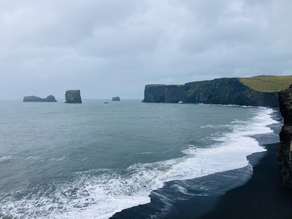
Reynisfjara Beach is a sandbar that runs east to west. We were on the eastern end of it. The western end of the sandbar almost touches the towering cliffs of the island of Dyrhólaey. The island is connected by a causeway and we drive around to it and park next to the trail head at Dyrhólaey. In front of me is one of the most beautiful public restrooms I’ve seen. I stop to admire it and take a picture.
Looking further west from the trail at Dyrhólaey is the view above. Access to the black sand beach is closed off with a rusted chain and a sign that says it is too dangerous to go down there. Eight years ago we had strolled on that beach for an hour and the kids had frolicked on the sand and played below the cliffs. I compare photos – the strip of black sand is much narrower today and it does look precarious with no way to run from a rouge wave.
You may not be able to spot it in the photo above but there is a dot of orange up on the cliff. That is the Dyrhólaey lighthouse and our next destination.
The view from the Dyrhólaey lighthouse is stunning. Cliffs drop away on three sides and puffins cling to tufts of grass. Far below them the black sand beach stretches to the horizon. This is our last stop before a two and half hour drive back to the big city lights of Reykjavik. About halfway back to Reykjavik we drive through the town of Selfoss. There is a Bobby Fischer museum here. In 1972 Bobby beat Boris Spassky in Reykjavik to become the chess world champion. It was the chess match of the century, the chess version of Rocky, a proxy war between the US and back then the USSR, and Bobby returned to America a hero and a household name. In 1992 Bobby, by then more notorious for his antisemitism than his chess, and Boris played again in Yugoslavia. Bobby ignored US and UN sanctions to go to Yugoslavia and a warrant was issued for his arrest by the US government. Bobby never returned to the US. He was eventually arrested trying to leave Japan years later, and while he was in prison there awaiting extradition to the US, he was granted full Icelandic citizenship by the Alþingi on the strength of his 1972 world championship in Reykjavik. Bobby died in 2008 in Iceland and is buried in Selfoss.
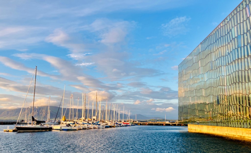
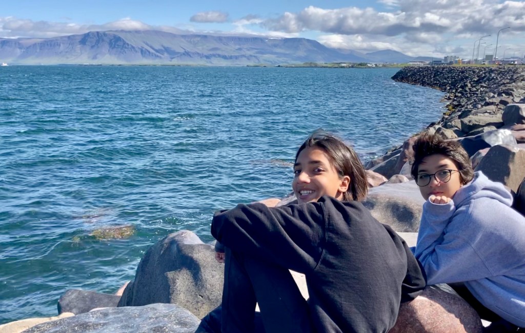
We get to Reykjavik and check into our hotel downtown. I look around and find a pho place around the corner. People with Vietnamese sounding names have given it good ratings on google. A few minutes later Vivian, Evan and I are slurping up pho with four heaping spoons of chili oil. Ahh – it is sooo good.
That evening I take a stroll around downtown. It is a beautiful evening and I run into crowds of tourists and some locals. At 10:30 at night it is bright enough to do brain surgery outside. Next morning we pack and I take another walk around downtown, this time with the fam. We are excited to be going home, but mostly we are excited to see Ouiser who Grandma has been taking care of. We are not looking forward to the 67 consecutive days of over 100 F days back in Texas.
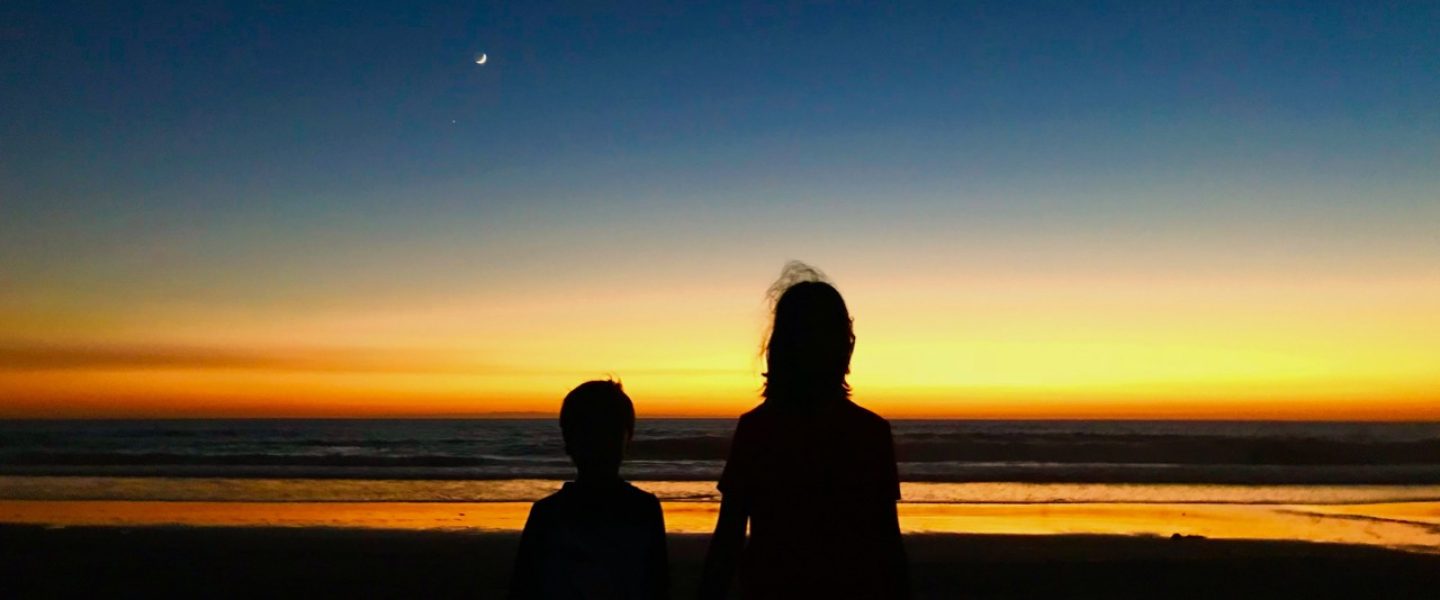
We travel well. Fourteen days driving around in Iceland, preceded by two weeks of Jo and the kids driving through Virginia and Maryland. This trip felt different. Vivian and Evan interacted with each other as almost adults. And Jo and I think they had a good time. As the plane rises up into the deep blue sky and the island falls away below us, Jo’s face says it all….
Today we have a three hour relaxed drive from Jökulsárlón, the glacier lagoon, to Skógafoss, one of Iceland’s well-known waterfalls. Most of the ring road here is not far from Iceland’s southern coast. We start the morning by driving around the glacial fingers of ice coming down from Hvannadalshnúkur, Iceland’s highest peak, and the southernmost extention of the Vatnajökull ice cap.
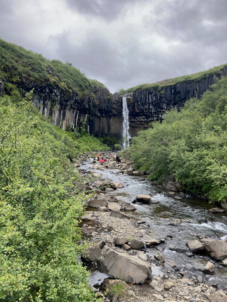
We drive into the Skaftafell Visitor Centre, a part of the huge Vatnajökull National Park. I take a short 2-3 mile hike to see Svartifoss, a pretty little waterfall surrounded by basaltic columns. At the park I read about the flooding here in 1996 and look down at the flood plain from a viewpoint and see where the flooding created giant ripples in the flats below. We get back on the ring road and drive over the black sand flats that connect the sea on our left to the mountains and glaciers to our right. In a few minutes we drive past the twisted steel beams of the Skeiðará Bridge Monument. During the 1996 floods, and several times since, including during the infamous 2010 Eyjafjallajökulleruption that halted air travel in most of Europe for a couple of weeks (Sharath was conveniently stranded in Amsterdam during this time), there were subglacial eruptions in these areas. A tremendous amount of ice is quickly turned into water. The water initially lifts up the ice as ice floats on water, and then drains out of the volcanic caldera, leaving behind giant whirlpool patterns of ice. The warm water (actually it is pretty cold at 6-8 degrees C) then flows under the glaciers and lifts them up again like it pushed up the ice in the caldera. Eventually the glaciers can no longer hold back and millions of tones of melt water, rocks, and icebergs come crashing down across the coastal flats on their way out to sea. The ring road and several bridges here get destroyed by the floods and Iceland quickly builds them back. This road is the only connection to people in the eastern part of Iceland, where we were a few days ago. We saw lots of earthworks in progress and at least a few new bridges being built.
The vocabulary of a language often gives away things about the culture of the people that speak that language. Apparently the Inuit have a couple of dozen words for ice and snow (not 52 though, that’s a myth), and the Hawaiians have words that describe different types of lava rock. The Icelandic people have a word: jökulhlaup. It means glacial outburst flood. I bet there isn’t a word for that in Bangla.
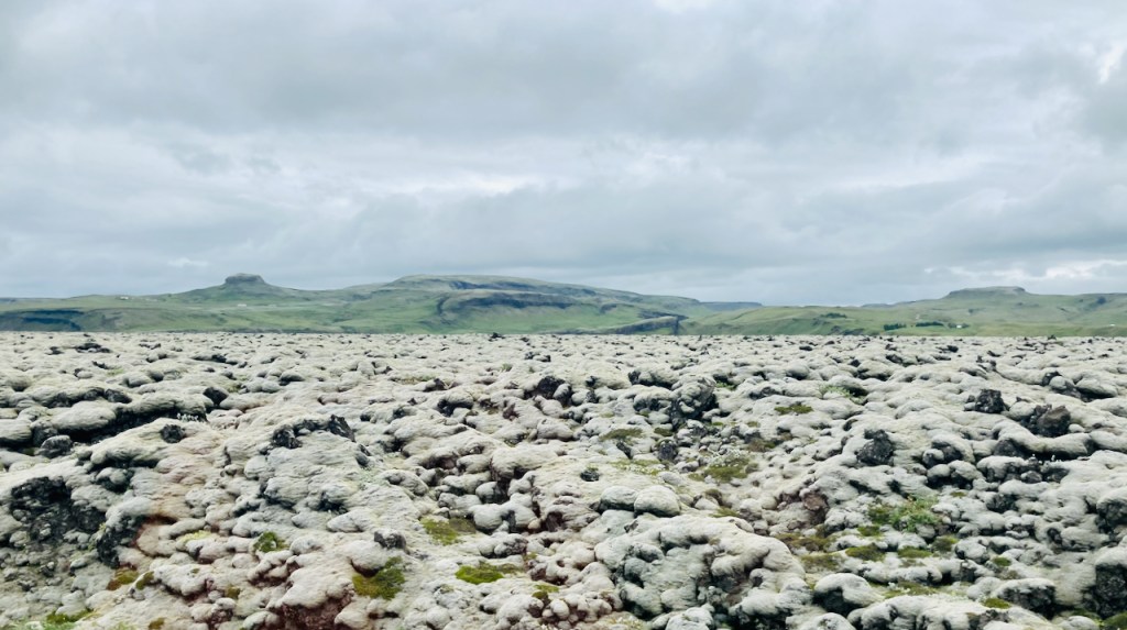
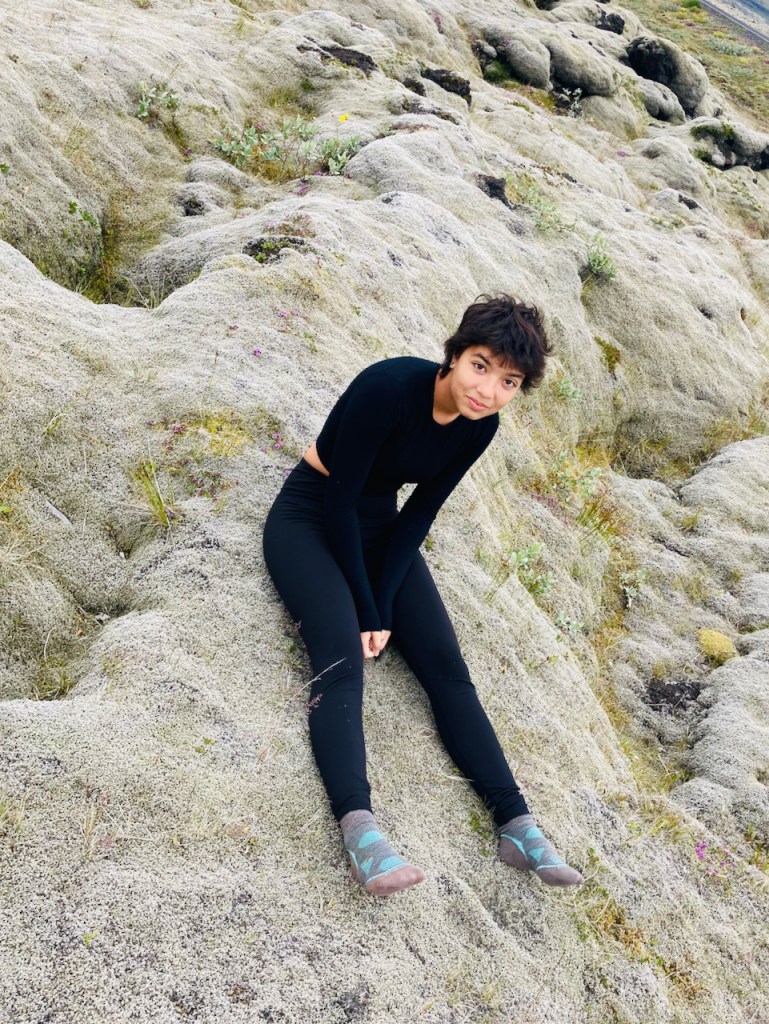
Gradually the scenery is less stark and the glaciers give way to rolling green meadows and steep rocky cliffs. For miles at a time we drive over what were once lava flows but are now shaggy layers of spongy light colored moss. It looks like someone has dribbled it over everything. We stop and goof around on the moss for a bit. It is soft and warm and has a pleasant smell and I could go to sleep in the perfectly sized depressions. Evan does fall asleep.
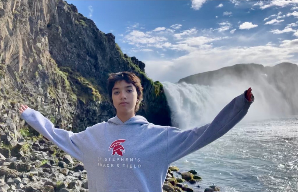
We stop at the little town of Vik for lunch. On the way out I see the church on the hill and ask Jo to take a hasty photo out of the car window. I remember taking an almost identical photo eight years ago. Soon after Vik we drive to our hotel next to the Skógafoss. The weather is nice and we think about walking up to the falls that we can see from our window. But we wait till it starts raining. Evan sensibly decides to stay nice and dry inside and at about 11pm Jo, Vivian and I put on our jackets and stroll out to base of the thundering Skógafoss.
The next morning is beautiful. We climb up a bunch of steps to the observation platform over the top of Skógafoss. In this last photo you can see a bit of the falls on the top right corner. On the bottom left corner you can see the curve of the black sand bank on this side of the river after the falls. You may be able to spot a few tiny people standing right at the edge of the shore there. That is where Vivian was standing in the photo the night before.
Tomorrow is our last full day in Iceland. I am already missing it. Though I can’t wait to see my doggy again!
Vatnajökull is Europe’s largest ice cap. It covers an egg shaped area about 150 km long and 100 km wide. In places it is over one kilometer deep. Though Iceland got its name when Raven-Flóki saw an ice filled fjord in the north west of the island, if there is a heart of ice in Iceland, it is here on Vatnajökull. Snow falls on Vatnajökull and over centuries it is compressed into clear bubble free ice. In places all around its perimeter, under the force of its enormous weight, the ice cap very very slowly descends in tongues of ice. One of these tongues of ice on the southeast side of Vatnajökull is Breiðamerkurjökull, a name that just rolls off your tongue. In the map below, it is the small darker green patch that leads down to the coast at about 5 o’clock.
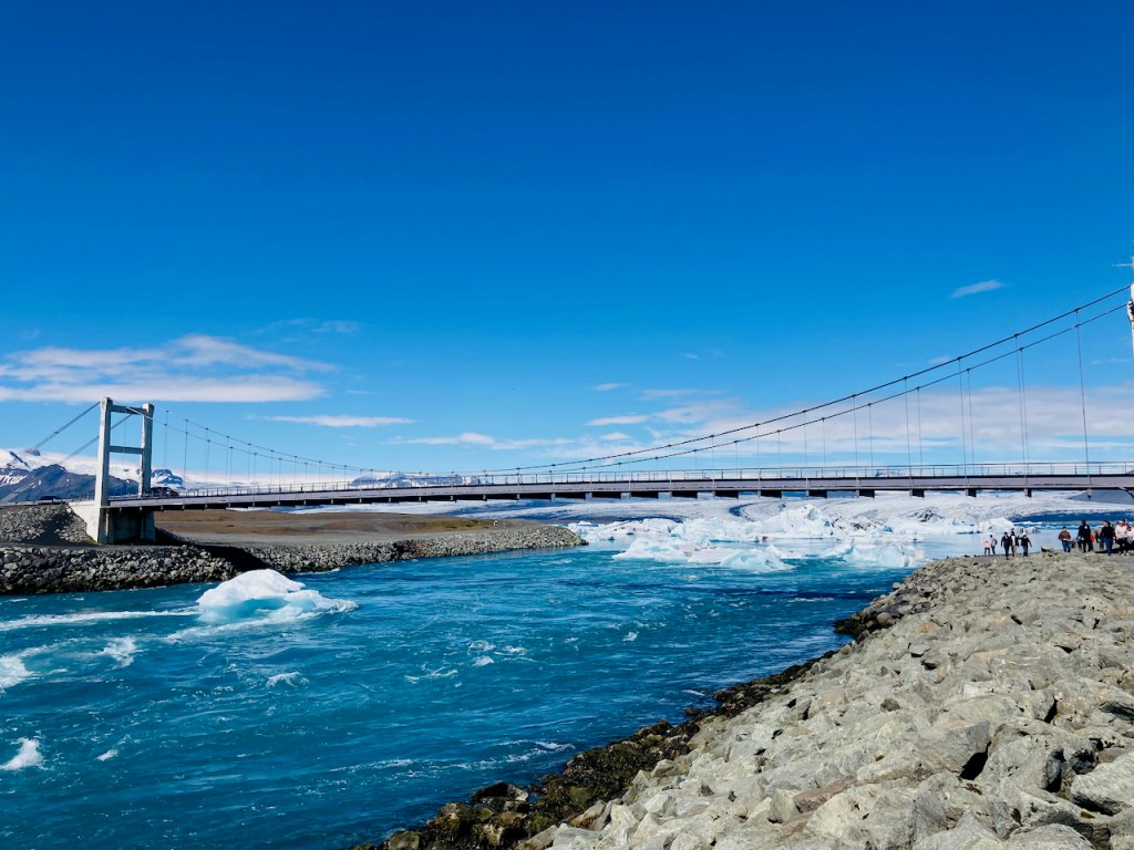
As the ice cap shrank, Breiðamerkurjökull retreated from the Atlantic and left behind a depression in the earth’s crust created by the weight of the ice over thousands of years. In the past century this became one of Iceland’s newest but deepest lakes. Most of the other glaciers end in braided rivulets that becomes streams and then rivers of glacial melt. Breiðamerkurjökull terminates at Jökulsárlón – the glacier lagoon – where ice calves off the glacier, floats around in the lake, and then flows out to sea under the one-laned suspension bridge on the ring-road.
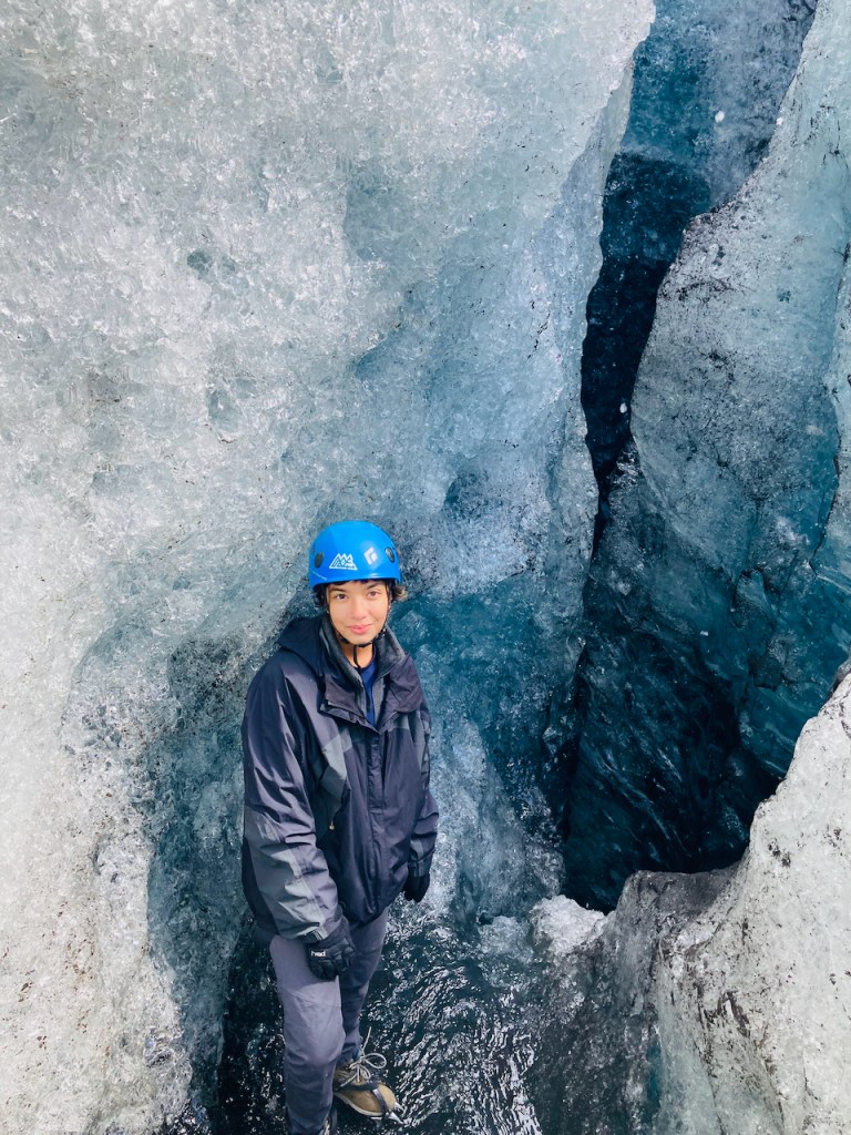
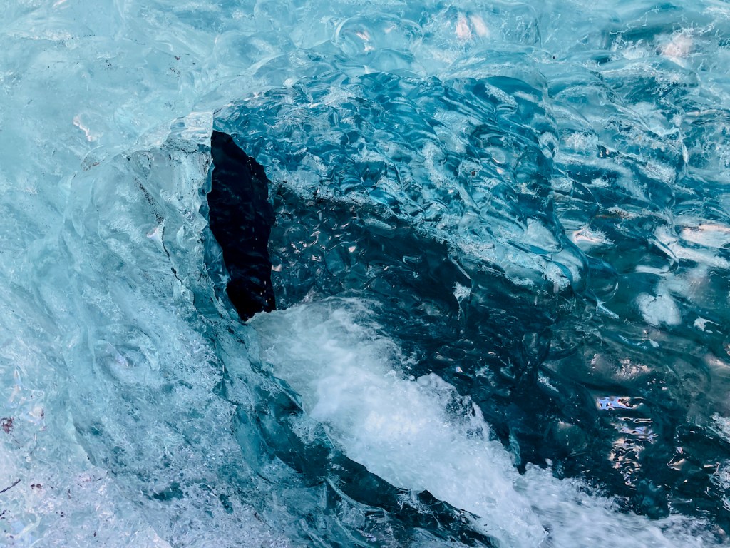
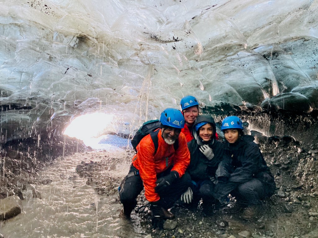
Jo had planned a glacier hike for us. We got into an enormous franken-jeep and drove along a very rocky path on the eastern flank of the retreating glacier up to where a new lake is being spawned. Then we walked another mile or two up to the ice, put on our harnesses, crampons, and brain buckets, and then took a nice guided walk up the lower part of Breiðamerkurjökull. We got to descend a part of the way into a crevasse and we explored an ice cave.
The bad news is that this glacier is melting fast. We can quibble about what is causing it. Evan’s grandkids will one day be incredulous that their grandpa actually walked on one of those things called glaciers. In the next 50 years the probability of bringing back dinosaurs is higher than for saving glaciers. During our lifetimes, in South Asia, between Pakistan, India, and Bangladesh, over 700 million people’s food and water sources and way of life will be disrupted severely by the disappearance of some of the world’s largest glaciers.
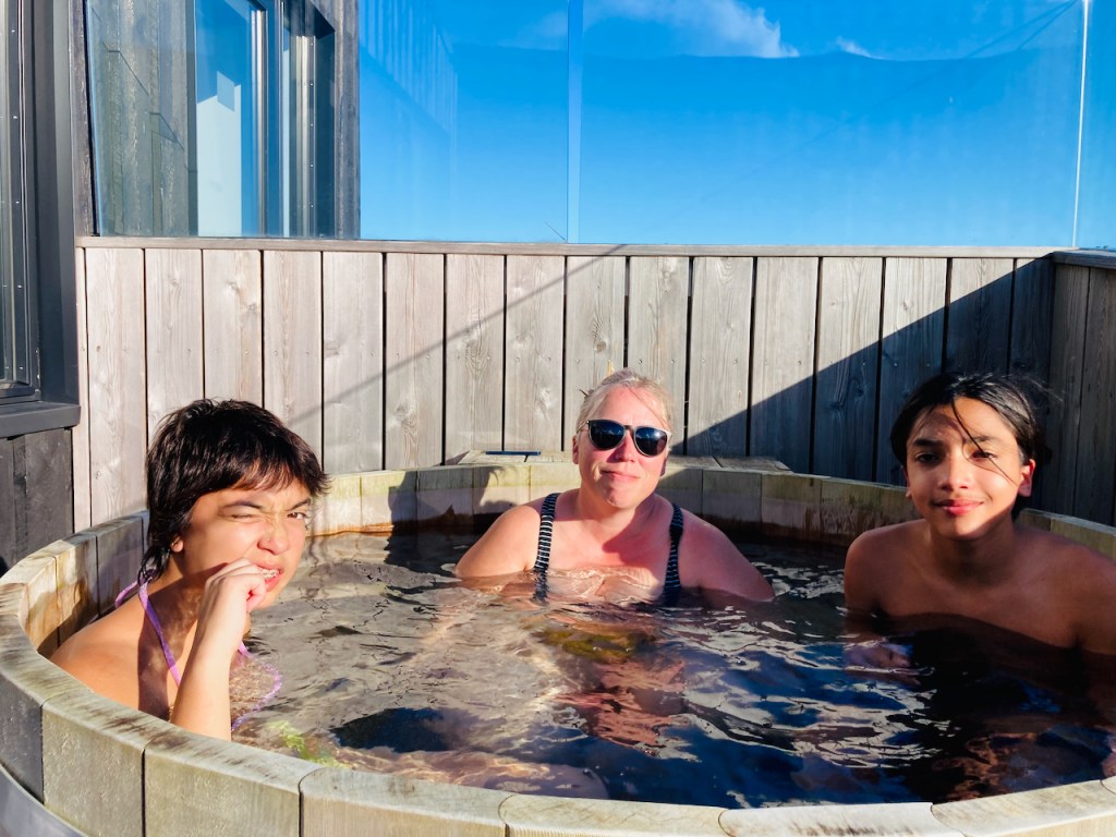
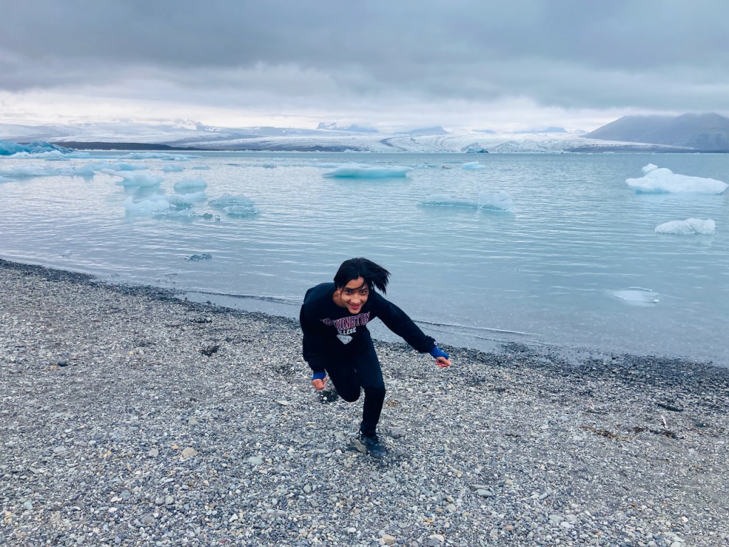
This depressing news made me very sad and when we got back to the hotel I finished the rest of the bottle of Olafsson Icelandic gin while Jo and the kids got into the nice wooden hot tub that was filled with hot water without requiring fossil fuels. In the morning we went back to stare at Jökulsárlón some more and to walk along it’s shores and up to the swirling blocks of ice on the beach on the Atlantic side. In the very last photo Evan is running along the lake like a freak. Behind him and across the lake is Breiðamerkurjökull. To the right there is a brown hulking mass of a rocky mountain sloping up above the glacier. The four of us were up there on the ice yesterday for the walk of a lifetime! Thank you, Iceland.
It’s Day 10. We have to go from northern Iceland to the eastern fjords. The drive takes us into the desolate highlands further than we have been before. But first we climb an extinct volcano.
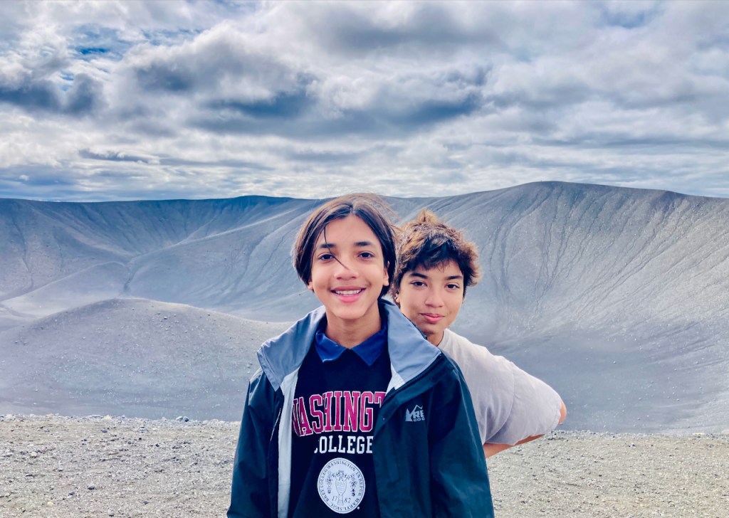
Hverfjall is a 1000 foot tall pile of grey tuff. About 2500 years ago there was a tephra explosion. Magma ran into water on the way up which turned the lava into bits of something called tuff, ranging from particulate ash to furniture-sized rocks. Then it all blew up and made a beautiful conical volcano. Almost nothing has grown on this tuff since long before Jesus was a twinkle in his father’s eye. We climb to the top and pose for a photo in front of the bowl of the crater. The rim is an almost perfect circle about a kilometer in diameter but we are too lazy to walk around. In the second photo below, you can see the cars down in the parking lot. The view from up here is great.
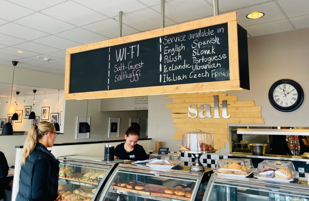
Then we drive for a few hours till we get close to the east coast and we stop for lunch at the town of Egilsstaðir. The waiters at the restaurant there speak more languages on any given day than at the UN. After lunch (and a brief stop at the Netto across the street for more spicy mini sausages) we start driving up the mountain to the east of town. Our destination is a small town at the end of a fjord on the other side of the mountains. The view to the west is amazing. To the east the mountain levels off and we are in a the high heath with patches of snow around the road. Then clouds creep in. Pretty soon we are in thick pea soup. We are descending through god knows what. The road is narrow with occasional guard rails. I think there is water on either side, or steep drop offs. We crawl down the road practically feeling our way. As we descend we finally get below the cloud bank and we see a green valley with a stream running through it and waterfalls along the way. We are in Seydisfjordur, our destination for the night.
Seydisfjordur is a lovely little town of 700 people. It is at the end of a fjord with steep mountains on either side that should be towering above the town but are completely hidden by a think bank of clouds close enough to touch from the upstairs window of our Airbnb. This evening the town is bursting at its seams with young people. Cars are parked in every possible spot and tents are pitched in front and back yards. Hundreds of people have descended into town for the LungA 2022 art festival. There are panels and performances and live music and kids wandering around with pillows and picnics. There is a pub right at the entrance to town and everyone is stopping by to drink a beer. The lone Lögreglan (cop) drives by slowly every few minutes. This is where having to plan and reserve things suck. We’d have stuck around for a few days and enjoyed Seydisfjordur but tomorrow at noon we are going to climb a glacier 400 km away. So we walk around and take some pictures in front of the powder blue church with the pride-painted path. Jo does three loads of laundry (really). And we get to bed for an early start tomorrow.
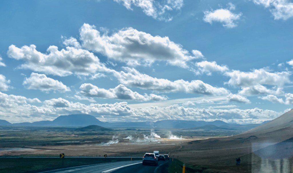
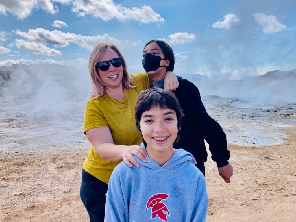
Today we explore a few places around Lake Mývatn (because so many Icelandic names include the word for “waterfall” or “lake” or “mountain” in the name I am be constantly making the chai-tea faux pas). And furthermore, we are going to strictly stereotype Iceland and only see things related to geothermal activity or waterfalls today. So our first stop is Hverir, the geothermally active region at the base of the Namafjall mountain (chai-tea again). As we descend down the pass over the mountain we see steam rising from the fumaroles half a mile away. Soon the smell of farts is strong enough to make Evan gag. I repeat my old central Texas joke about hydrogen sulfide laden air:
How do you know you’re driving through Luling, Texas?You roll up the windows when someone farts.
Something about the abundant smell of farts makes everyone act like a child. We laugh wildly as we run from one bubbling mud pot to another.
Evan is distinctly taller than both Vivian and Jo (not much of a feat), and is close to catching up with me (not a feat either). But you can see Jo trying to push Evan down in the photo above so he doesn’t look taller. Eventually we tire of fart jokes and we drive a few miles north to Krafla. Along the way we see the Krafla geothermal station. Steam at high pressure from about two dozen boreholes are fed into two turbines at the station to generate electricity. The Krafla power plant is Iceland’s largest geothermal power plant and provides about half of Iceland’s entire residential power needs. Construction of the power plant was interrupted by an active lava flow during the 1975 swarm earthquakes. One of the boreholes holds the world record for producing the hottest steam (430 degreed C), supposedly because it is so close to the magma. I’m thinking we’re pretty darn close to magma even up here on top.
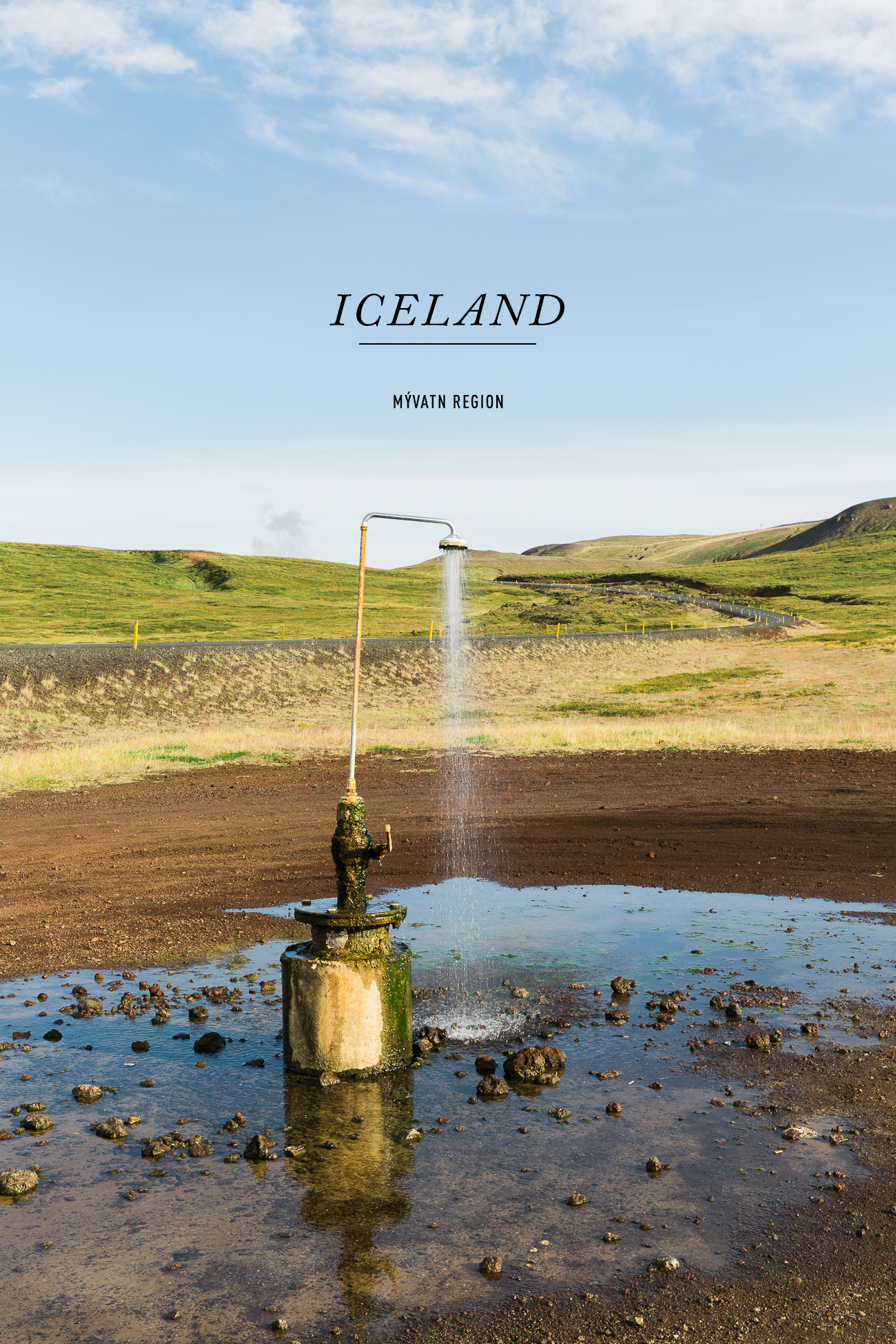
A by-product of the power station that is more famous than the electricity it produces is the Douche Perpétuel. No, not The Donald. This perpetual douche is a shower beside the road next to the power station that always has warm water coming out. There is no faucet to turn it off. People often pull up and park and strip and shower right here. There is no one today and we don’t stop for a photo, but I have linked to See and Savor’s photo from her blog.
We drive past the Douche Perpétuel and under steam pipes at the geothermal station to where lava flowed during the 1975 activity. We park and walk across about a mile of lava rock to a small pale blue lake that is gently steaming. Further to the west we see the extent of the lava flows. Black fresh lava rock covers many miles of low-lying land, rising up around the edges of hills and nearby mountains. Steam emerges from fumaroles though it doesn’t smell half as bad as it did down in Hverir. Or perhaps I am desensitized to farts.
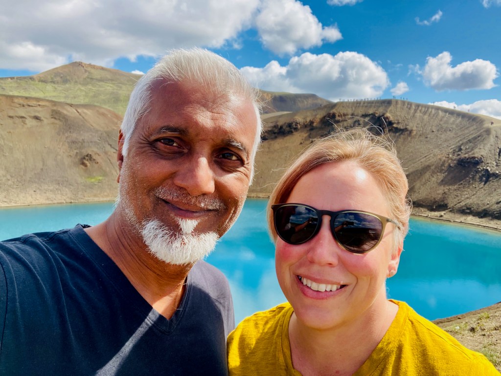
On the other side of the Krafla flows is a crater lake with the bluest water. There is a path around the rim of the crater – if you look carefully there is a long line of people just over Jo’s head. We drive back down the way we came, past another older geothermal power station and another very blue lake.
Then I need to join a zoom for work for an hour. I put on my headphones and zone out. My phone’s signal is good enough to carry on a video zoom with several people scattered around the US while Jo drives us to our next destination, conveniently just over an hour away. When I finish my meeting I find that Jo has taken one of her famous shortcuts and we in the middle of nowhere. We are on a narrow remote dirt road. A few minutes later we turn up into one of those dreaded F-roads, but just for half a mile. We park and walk the last mile and arrive at one of Iceland’s most dramatic and remote waterfalls – Aldeyjarfoss. The Skjálfandafljót river (“the river of trembling rapids”) gushes out of a barren rocky moonscape down twenty meters of basalt columns into a churning cauldron of seething water before making a right angled turn and flowing on downstream.
We stay and enjoy the stark beauty of Aldeyjarfoss for a while. Then we drive downstream along the Skjálfandafljót river on to another one of Iceland’s famous waterfalls, Goðafoss. There are tour buses and paved trails here and we descend to the level of the river below the thundering falls. According to one story, this is where the law speaker of the Icelandic parliament threw his pagan idols away after Iceland converted to Christianity. So, God Falls.
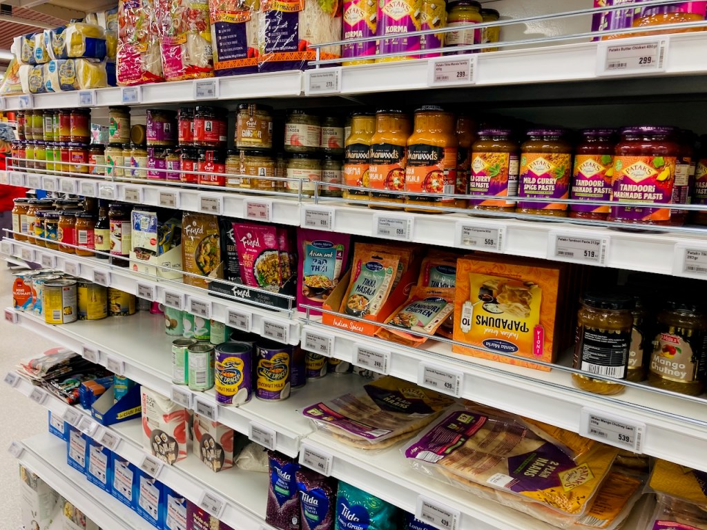
We stop at the Netto in Húsavík on the way back. I am amazed how well stocked these small grocery stores in this tiny places are. There are more spices and Indian and Thai food on the shelves than at big chain grocery stores in Falls City, Nebraska or Hiawatha, Kansas (I only compare with these because I am somewhat familiar with them). And there is Stubb’s barbecue sauce all the way from Austin! We pick up some fresh North Atlantic salmon and head back for our last night at Svartaborg.